New Geocaching.com Maps
We are the .35%
A few months ago, Google announced a change to its Maps API licensing structure that requires third-party websites with over 25,000 map loads per day to pay for use of the API. (Visit Google for more details on their pricing structure.) According to Google the new limits should affect only around .35% of maps consumers. Geocaching.com averages about 2,000,000 map loads per day, placing us firmly within that small percentage of affected consumers.
After discussing available options, we made the difficult decision to reduce our reliance on Google Maps and take steps to better integrate Leaflet and OpenStreetMap. This decision was based, in large part, on our ability to bear the very significant cost of licensing Google maps given our high rate of consumption. It was also based on the advantage we gain in many ways using new tools that allow us to grow our technology and the service we provide.
OpenStreetMap Benefits – Enter the Rainbows
and Unicorns
Creative Commons, Community Driven, Constantly Updated
OpenStreetMap is freely and publicly editable in a similar way as Wikipedia. Anyone can change or add to the maps and thousands of people worldwide contribute on a regular basis. As a result, the maps are constantly improving, and as a community we can grow the map database while we geocache.
What happens when a large number of passionate people pull in the same direction? Well, geocaching, for one. Our passionate community grew this hobby from one geocache to more than 1.6 million.
OSM Maps are Good
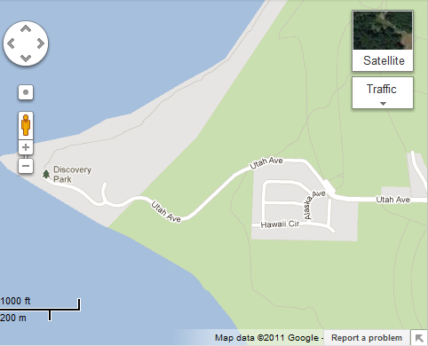
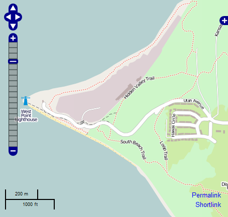
While OpenStreetMap is known widely in Europe, much of the rest of the world is unfamiliar with the mapping software. OSM maps accurately represent location, not only at the street level but also at the level of buildings and infrastructure. Even walking paths in many parks are included. Here is one comparison showing the level of detail provided.


*Note the dotted-line trails depicted in the OpenStreetMap example. These are hiking trails contributed by Open Street Maps users and are refined on a continuous basis.
New features
Leaflet, the lightweight JavaScript library for tile-based interactive maps, is replacing our current Google implementation. It provides us with more flexibility to offer features that previously had not been possible. Including:
- Support for tablets like the iPad and other mobile devices
- Display of only the caches in a Pocket Query instead of all caches at once
- Faster tooltips, at any zoom level
We also intend to build out our own tile server in the future which will speed up the loading of map tiles enormously.
Moving Forward
We remain committed to providing great mapping resources to our customers and believe that both the global geocaching community and our website benefit from this change. With ongoing innovation and new technologies being developed every day, geocaching will continue to evolve.
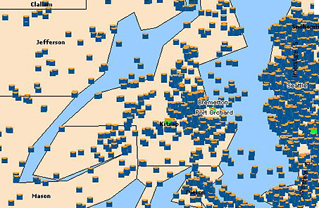
We have certainly come along way. Here is a glimpse of our old maps (circa 2005):

You can check out the new maps here.
 Just another sign to go geocaching with a fri
 This geocache rocks
 Geocache of the Week
 ‘Orange’ you glad you checked there for t
 Taking geocaching to new heights!
 Sometimes, the geocaches just hide themselves
 Patience is a virtue